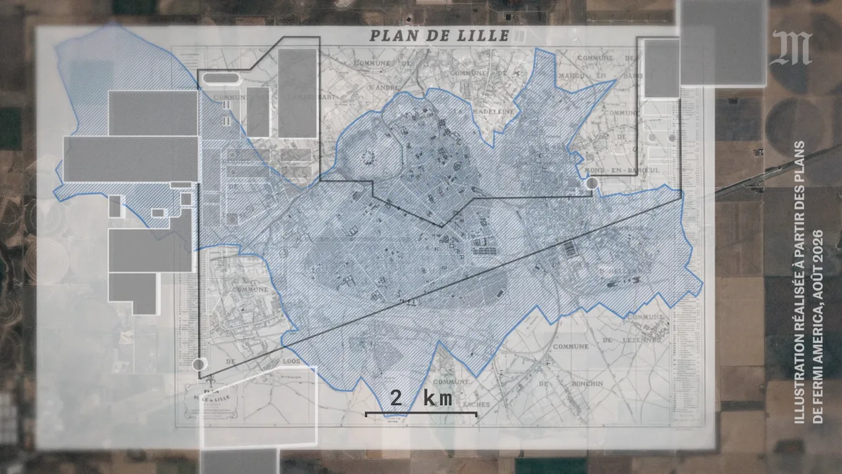
A data center campus overlaid on the plan of Lille
Scale comparison between the footprint of data center buildings, shown on satellite imagery, and an old plan of the city of Lille. The illustration overlays the extent of Lille and neighboring municipalities on that of an industrial site.
- Author
Shared by Loïc PICAVET
- Places
- Collection
What the map shows
The map overlays an old plan of Lille, with its neighboring municipalities (Lambersart, La Madeleine, Marcq-en-Barœul, Mons-en-Barœul, Hellemmes, Lezennes, Ronchin, Faches, Loos), on satellite imagery of farmland. The hatched blue outline marks the city of Lille. The grey rectangles represent the buildings of a data center project, and a thin black polygon outlines the overall footprint. The 2 km scale bar allows surfaces to be compared. The image is an illustration made from Fermi America plans in August 2026; it has no detailed legend or figures, and the footprints are schematic.
Sources
- Fermi America (plans)
- Le Monde