Shipwrecks, ports, lighthouses: land seen from the sea
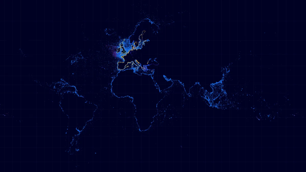
World map of glowing points on a dark background showing shipwrecks, ports and lighthouses. The points trace the outlines of the coasts, with a high density in Europe.
- Author
 Bastien MARSAUDPolygonia
- Collection
What the map shows
The map overlays points for shipwrecks, ports and lighthouses, drawn from EMODnet data retrieved through a WFS service. Since no point lies on land, the coastlines appear only through the alignment of the points, on a dark blue background with a grid of meridians and parallels. The colours (blue, yellow, purple) distinguish data types, but the image has no explicit legend. Concentration is very high around Europe, the English Channel, the North Sea and the Mediterranean, and lower elsewhere. This density probably reflects data coverage, more complete in Europe, rather than the actual distribution of wrecks.
Sources
- EMODnet