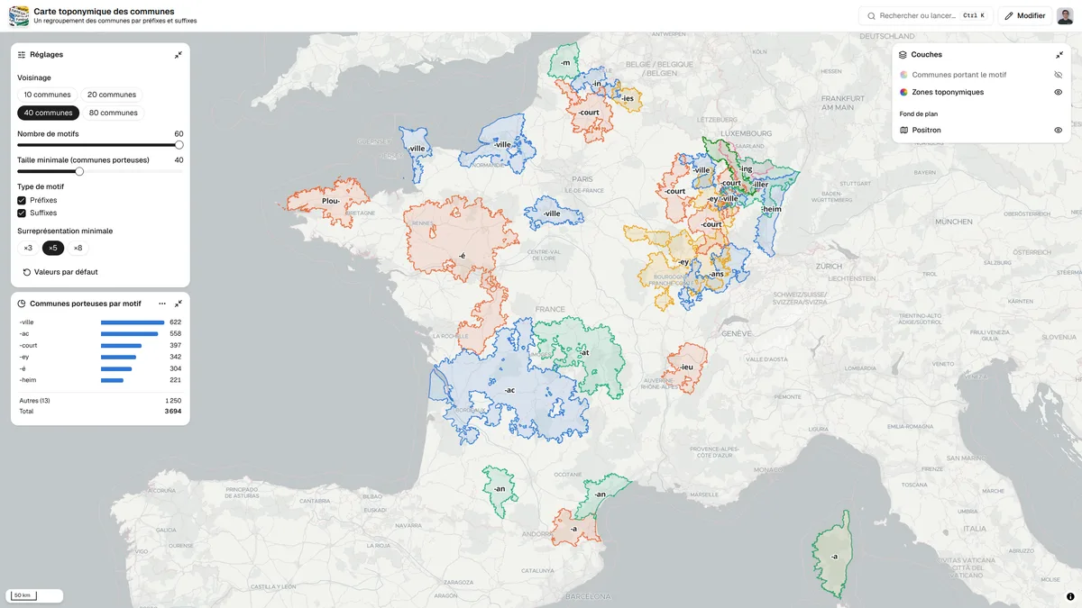
Toponymic map of municipalities
Map of mainland France grouping neighbouring municipalities that share the same name prefix or suffix into zones. A settings panel lets users change the neighbourhood size and the over-representation threshold.
- Author
 Bastien MARSAUDPolygonia
- Places
- Collection
What the map shows
Each municipality is compared with its neighbours: a pattern (prefix or suffix) is kept if it is locally over-represented compared with France as a whole, to a degree that chance cannot explain. Neighbouring municipalities carrying that pattern form a coloured zone, labelled with the pattern (-ac, -ieu, Plou-, -heim, -ville…). Examples include the -ac names of the South-West, the -ieu names around Lyon, the Breton Plo-/Plou- names and the -heim names of Alsace. Settings cover the number of neighbours (10 to 80), the number of patterns, the minimum size, the pattern type and the over-representation threshold (×3, ×5, ×8). A chart shows the number of municipalities carrying each pattern. The zones depend on the chosen parameters and are not a linguistic analysis.
Sources
- DINUM (data.gouv.fr)View
- IGN
- OpenStreetMap
- OpenMapTiles