Review of the 2024 floods in Europe
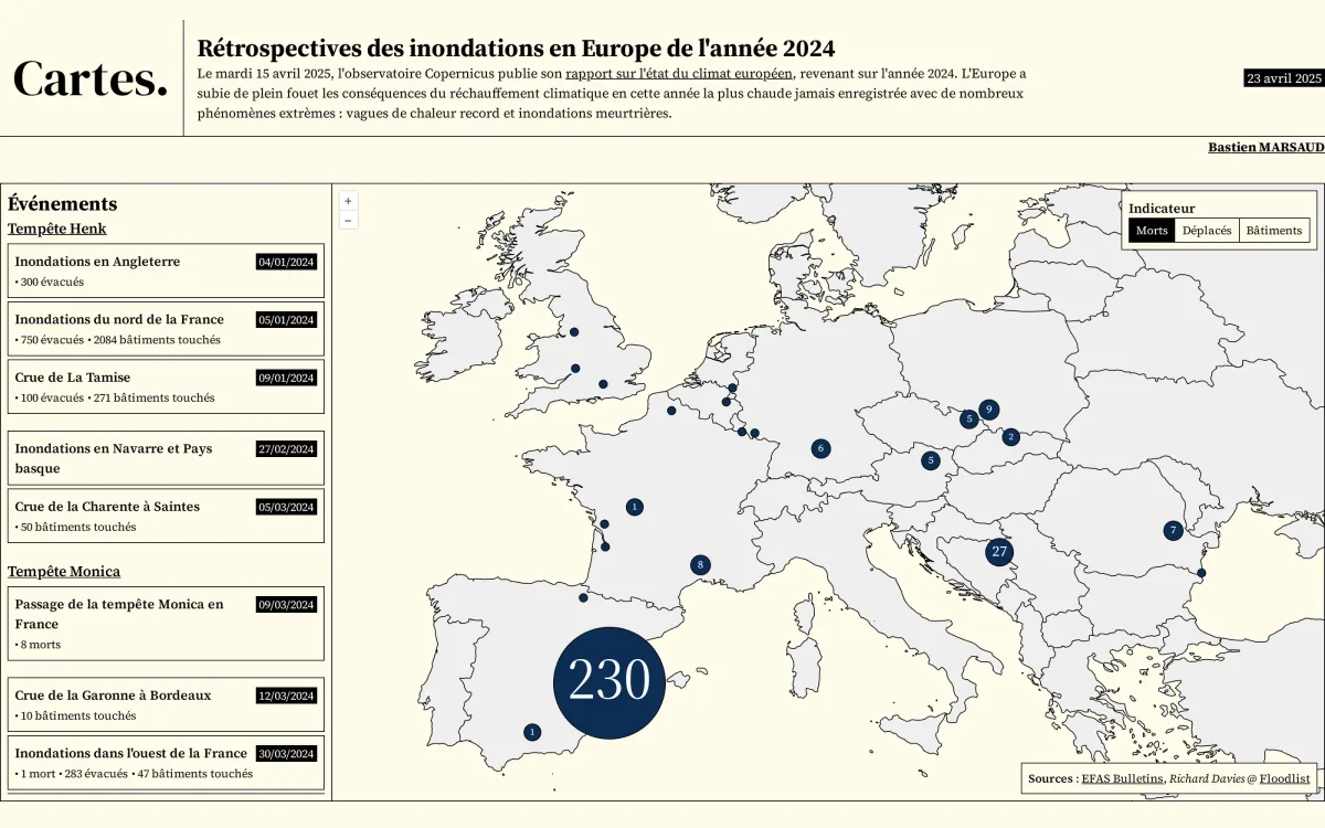
Interactive map of the main floods in Europe in 2024, with circles sized by the number of deaths, displaced people or damaged buildings. It covers Europe, with a chronological list of events grouped by storm.
- Author
 Bastien MARSAUDPolygonia
What the map shows
The map plots the 2024 floods across Europe using EFAS bulletins and the Floodlist database. A selector lets users choose the indicator displayed: deaths, people displaced or buildings affected. Circles are proportional to the value and are clustered when events are close together (for example, 230 deaths in Spain and 27 in the Balkans). The side panel lists events by date, with their figures, for example Storm Henk in January or Storm Monica in March. The context is the Copernicus report on the state of the European climate, published in April 2025. The figures depend on the bulletins available and are not exhaustive.
Sources
- EFAS Bulletins
- Richard Davies @ Floodlist
- Copernicus