Where the Cloud Lands in US
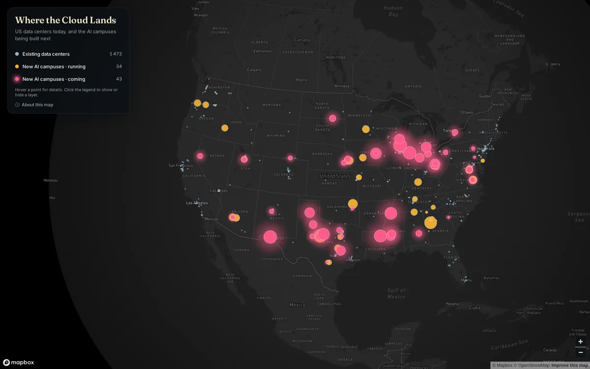
Point map of existing US data centers and of large AI campuses that are running or under construction. It covers the United States, with neighboring countries shown in the basemap.
- Author
Shared by Loïc PICAVET
- Places
- Collection
What the map shows
Grey dots show 1,472 existing data centers mapped in OpenStreetMap. Circles show the large AI campuses tracked by Epoch AI, sized by the power they will draw when fully built: amber for those already running (34), glowing pink for those under construction or expanding (43). The large campuses under development cluster notably in Texas, the Midwest, the Southeast and the Southwest. Some campuses with no public address are placed at their town. The map is interactive (hover, clickable legend); it does not show actual consumption data.
Sources
- IM3 Data Center Atlas (PNNL)
- OpenStreetMap contributorsView
- Epoch AI Frontier Data Centers