Lyon public transport in real time
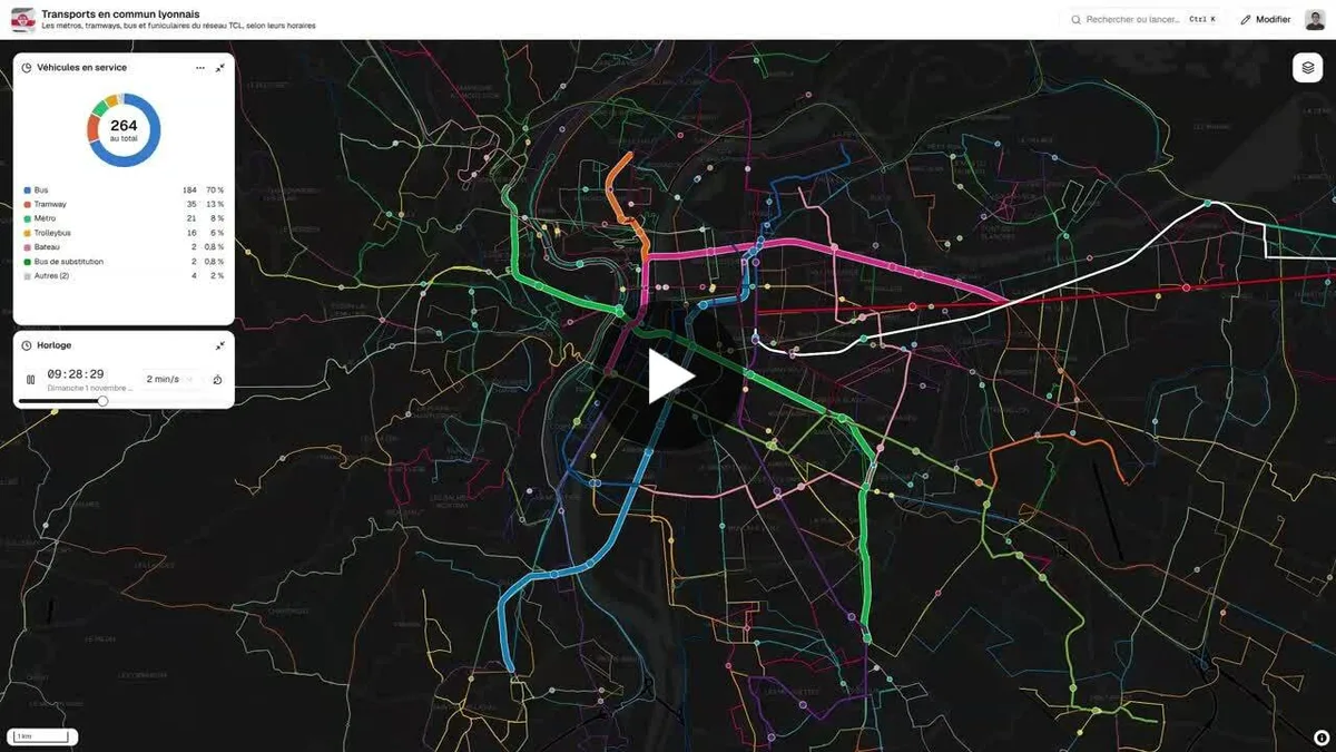
Animated map of the Lyon public transport network (metro, trams, buses, trolleybuses, funiculars, boats) showing vehicle positions computed from timetables. It covers the Lyon Metropolis.
- Author
 Bastien MARSAUDPolygonia
- Themes
- Places
- Collection
What the map shows
The map, on a dark background, displays the network lines colored by line or mode, with stops and moving vehicles. Positions are computed second by second from the passing times at each stop, taken from GTFS data. A "Vehicles in service" panel shows 264 vehicles in total: 184 buses (70%), 35 trams, 21 metro trains, 16 trolleybuses, 2 boats, 2 replacement buses and 4 others. A "Clock" component sets the simulated time and playback speed (here 2 min/s). This is a simulation based on scheduled timetables, not positions measured by GPS.
Sources
- SYTRAL Mobilités (données GTFS)