The pesticide map near you
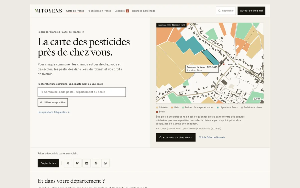
Map of a neighbourhood in Nomain (Nord) showing farmland around a school, coloured by declared crop family. The nearest plot, planted with potatoes, is about 36 m away.
- Author
- Collection
What the map shows
The map is a real example centred on a primary school in Nomain, in the Nord department. Plots are coloured by crop family declared in the 2025 RPG: cereals, maize, grassland, fodder and heath, vegetables and flowers, fallow and miscellaneous. The school is marked by a red point and the nearest potato plot is outlined, with its distance. This distance is measured from the point locating the school, not from the edge of its grounds. The map shows declared crops, not measured exposure to pesticides. The site also offers a search by municipality and a ranking of departments by an exposure index.
Sources
- RPG 2025 (IGN/ASP)
- OpenStreetMap
- Protomaps
- Cartobio