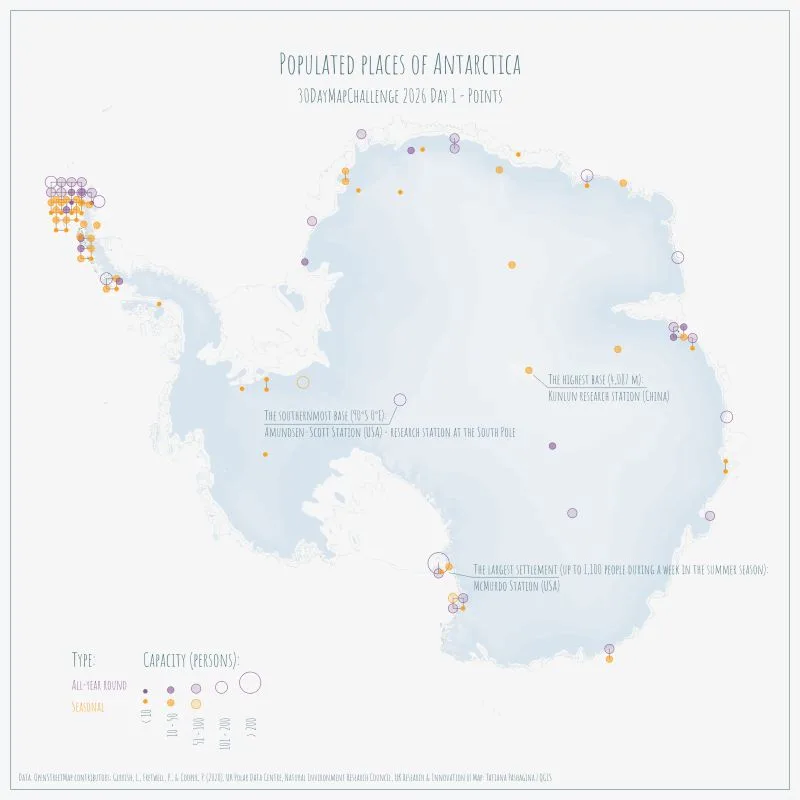
Populated places of Antarctica
Map of Antarctica's inhabited bases and stations, distinguished by occupation (year-round or seasonal) and accommodation capacity. It covers the whole continent, with a strong concentration on the Antarctic Peninsula.
- Author
Shared by Loïc PICAVET
- Places
- Collection
What the map shows
The map shows each populated place as a point whose colour indicates the type of occupation: purple for year-round stations, orange for seasonal ones. Symbol size reflects capacity in persons, in five classes from under 10 to over 200. Three landmarks are annotated: the southernmost base (Amundsen-Scott Station at the South Pole), the highest (Kunlun research station, 4,087 m) and the largest (McMurdo, up to 1,100 people in summer). The Antarctic Peninsula holds most of the settlements, while the continental interior has very few. The map does not state the data date and does not distinguish the operating countries.
Sources
- OpenStreetMap contributors
- Gerrish, L., Fretwell, P., & Cooper, P. (2020), UK Polar Data Centre, Natural Environment Research Council, UK Research & Innovation