Exclusive Economic Zones in the Arctic
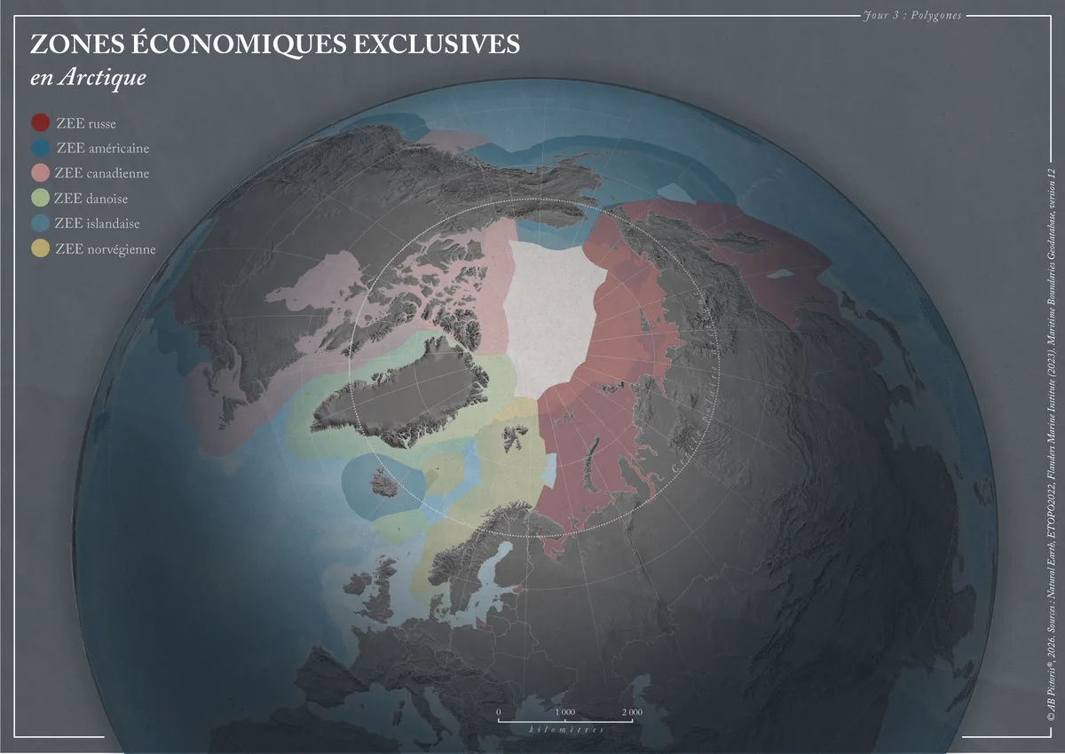
Map of the Arctic Ocean and its surroundings showing the exclusive economic zones (EEZs) of the bordering countries. Each country is identified by a colour over a shaded relief background.
- Themes
- Collection
What the map shows
The map shows a view centred on the North Pole, with relief in grey tones and the Arctic Circle drawn as a dotted line. The legend distinguishes six EEZs: Russian, American, Canadian, Danish, Icelandic and Norwegian, each in its own colour. The pale central area left uncoloured lies beyond these zones. The data come from Natural Earth, ETOPO2022 and the Flanders Marine Institute (Maritime Boundaries Geodatabase, version 12). The map is deliberately simple and does not show extended continental shelf claims or maritime boundary disputes.
Sources
- Natural Earth
- ETOPO2022
- Flanders Marine Institute, Maritime Boundaries Geodatabase v12View