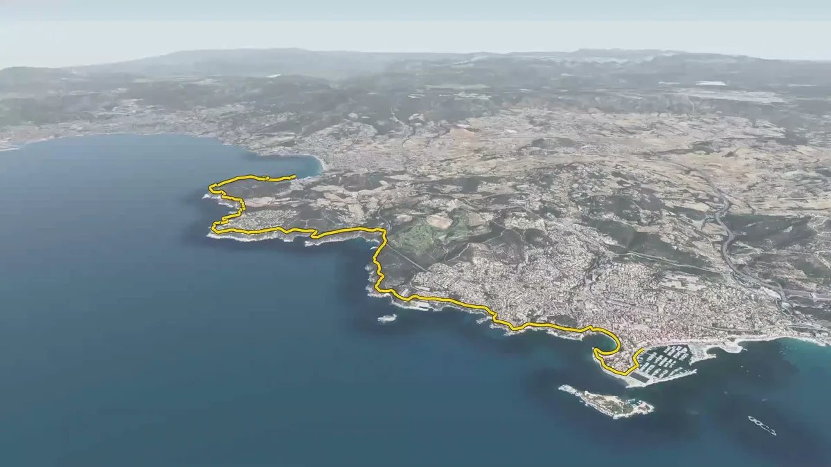
🗺️The coastal path, from Saint-Cyr-sur-Mer to Bandol, as the crow flies.
3D aerial view of the coastal path between Saint-Cyr-sur-Mer and Bandol, in the Var department. The route is highlighted in yellow along the Mediterranean coast.
- Author
 Bastien MARSAUDPolygonia
- Collection
What the map shows
The map shows an oblique 3D view of the Var coastline, with the coastal path traced in yellow from Saint-Cyr-sur-Mer to the port of Bandol. It shows coves, headlands, coastal development, the hilly hinterland and the island of Bendor offshore. The image is taken from a short video following the path. It has no legend or scale, and no data source is given.